
The hike from Amicalola Falls State Park to Springer Mountain, the southern terminus of the Appalachian Trail, is a challenging and rewarding experience for outdoor enthusiasts. This 15.5-mile round-trip journey takes hikers through the stunning scenery of the Georgia mountains, offering breathtaking views and the opportunity to connect with nature.
Distance and Time

- Distance: The round-trip hike is approximately 15.5 miles.
- Time: The hike can take around 8-10 hours, depending on your pace and the amount of time spent at the summit.
Trail Description
Initial Section
The trail begins at the AT Approach trailhead near the crest of Amicalola Falls, sharing its initial stretch with the Hike Inn Trail before veering left at 0.3 miles and following blue trail blazes.
Terrain
The trail descends through a rhododendron and laurel-filled forest, crosses a small creek and a road, and climbs elevation through a deciduous forest with mossy boulders and young hemlock trees.
Campsites and Shelters
There are campsites along the trail, including one at 3.1 miles and another at 4.25 miles.
Summit and Return
The trail reaches the summit of Amicalola Mountain at 3.6 miles and then descends to cross a gravel road. It continues northeast to follow blue blazes toward Springer Mountain. The return hike follows the same trail back to Amicalola Falls.
Logistics and Tips
Parking
Parking costs $5 or is included with a Friends of Georgia State Parks and Historic Sites membership.
GPS Coordinates
The trailhead GPS coordinates are 34.566933, -84.243583.
Difficulty
The hike is considered challenging, with significant elevation gain and loss.
Water and Supplies
Pack enough water and snacks, as the hike can be physically demanding. There are water sources and shelters along the trail.
Additional Information
Springer Mountain
Springer Mountain is the southern terminus of the Appalachian Trail and can be reached via the Appalachian Approach Trail from Amicalola Falls State Park.
Amicalola Falls State Park
The park offers lodging and camping facilities, as well as a visitor center with information on the trail and surrounding area.
Can I Link up to the Approach Trail From the Top of the Falls Using the Base-Of-The-Falls-Trail?
Yes, you can access the Appalachian Approach Trail from the top of Amicalola Falls using the Base-Of-The-Falls-Trail. This trail starts at the base of the falls and climbs up to the top, where it connects with the Approach Trail.
Is the Creek Trail or Base-Of-The-Falls Trail More Scenic?
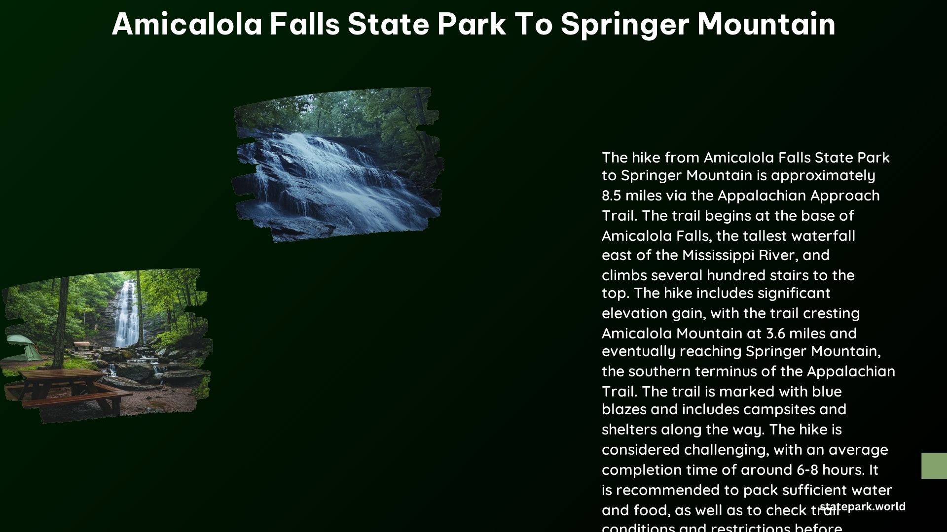
The Base-Of-The-Falls-Trail is generally considered more scenic than the Creek Trail. The Base-Of-The-Falls-Trail offers stunning views of the 729-foot Amicalola Falls, one of the tallest cascading waterfalls east of the Mississippi River. In contrast, the Creek Trail, while still beautiful, does not provide the same dramatic waterfall views.
References
- https://www.atlantatrails.com/hiking-trails/at-approach-trail-hiking-amicalola-falls-to-springer-mountain/
- https://www.reddit.com/r/AppalachianTrail/comments/1apxot6/noboamicalola_falls_or_springer_mtn_for_the_start/
- https://www.hashtag59.com/hashtag-59-blog/2023/10/31/appalachian-trail-section-hike-the-at-approach-trail-to-springer-mountain-georgia
- https://www.alltrails.com/trail/us/georgia/appalachian-approach-trail
- https://www.exploregeorgia.org/dawsonville/outdoors-nature/trails-tours/appalachian-trail-approach-trail